Satellite-Captured Carbon Dioxide Images


GHGSat Unveils Carbon Dioxide Plume Images
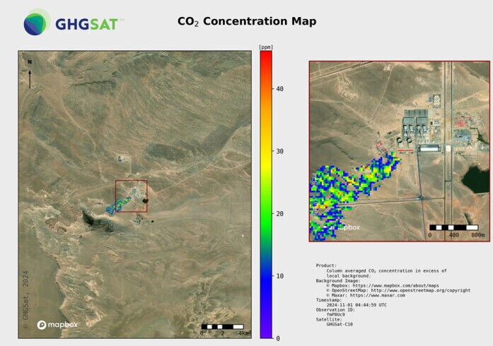
Kalin Ned — November 16, 2024GHGSat has unveiled carbon dioxide plume images captured by its Vanguard satellite. This is the first commercial satellite capable of pinpointing CO2 emissions from individual industrial facilities.
This technology marks a significant advancement in environmental monitoring as it offers high-resolution data that can trace emissions down to specific sources, such as power-generating stations. The data, presented at COP29, reveals the rate of emissions from a particular facility. This breakthrough is expected to enhance efforts in monitoring, reporting, and mitigating carbon emissions globally. By providing precise emissions data and carbon dioxide plume images, Vanguard helps improve the accuracy of emissions inventories and supports the global carbon trading market, which is valued at approximately $1 trillion.
GHGSat’s ability to measure emissions with such precision, coupled with its long-standing commitment to space-based environmental monitoring, makes this service valuable to industries and governments looking to meet climate goals and mitigate their carbon footprints.v
Image Credit: GHGSat


